Treks
Rush Lake and Patundas Trek
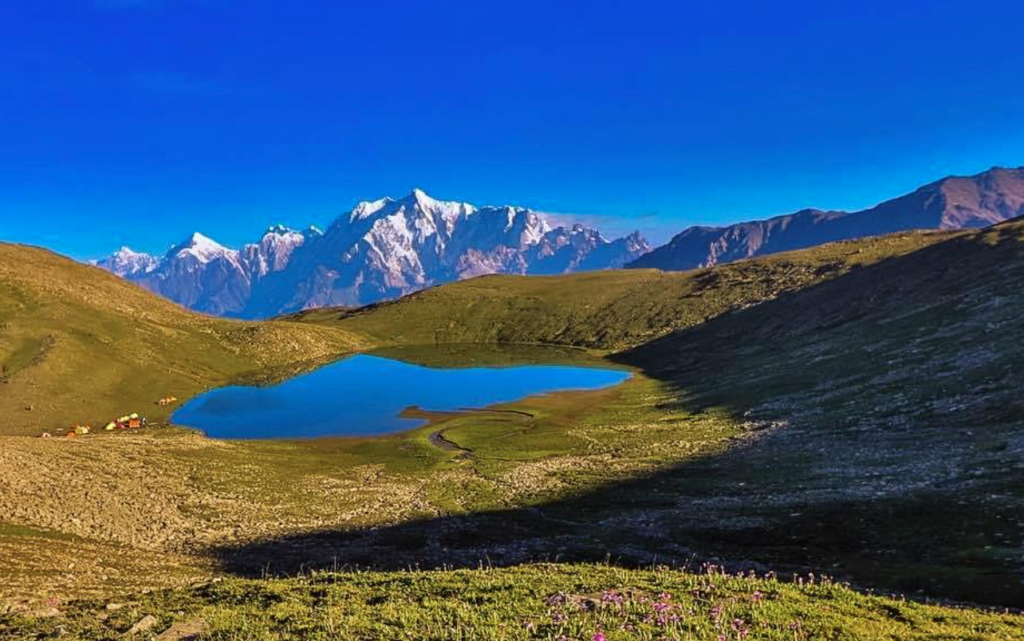
A 16-day guided trek through Upper Hunza to Rush Lake and Patundas Meadows with an optional Rush Peak summit at 5,098m.
16 daysModerate
Explore journey →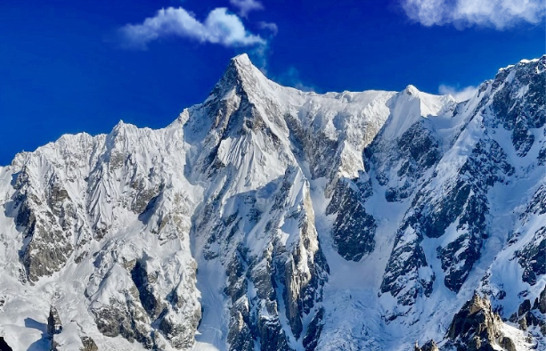
From Baltit Fort to the meadows beneath Ultar Sar and Ladyfinger Peak
THE JOURNEY
Ultar Sar rises 7,388 metres directly behind Karimabad, so close that the town sits in its afternoon shadow. Beside it stands Bublimotin, the slender granite needle better known as Ladyfinger Peak. The Ultar Sar Base Camp Trek climbs from Baltit Fort through a narrow gorge to Ultar Meadows, the summer pasture at the foot of the Ultar Glacier that trekkers treat as the mountain’s base camp.
Because it starts in the middle of Hunza, this is the most convenient overnight trek in the valley. It is short, steep and spectacular, and it fits easily into a wider tour.
The path begins just before Baltit Fort and follows an old irrigation channel into the mouth of the Ultar gorge. It then climbs steeply over moraine beside the stream to the shepherds’ huts at Ultar Meadows, around 3,270 metres. Avalanches rumble off the icefall above camp through the day. On the second morning a steep trail leads to Hon Pass at 4,257 metres, where the view takes in the Hunza Valley, Rakaposhi, Diran and the distant peaks of the Hispar and Spantik ranges.
Climbing expeditions to Ultar Sar itself use a different base camp on the far side of the mountain. For trekkers, Ultar Meadows gives the closest and most dramatic view.
The trek is moderate. The climb to the meadows gains about 800 metres in four to five hours on a steep, sometimes loose path. The optional ascent to Hon Pass adds roughly 1,000 metres more and is a demanding day. Good boots and trekking poles are important.
May to October. The meadows are green from June, and October brings autumn colour to Karimabad below. Early starts avoid the afternoon heat in the gorge.
IN PICTURES
DAY BY DAY
We meet you at Islamabad International Airport and transfer you to your hotel. In the evening your guide runs through the plan, checks your equipment and answers any last questions.
A long but beautiful day on the road north. From June to September we cross Babusar Pass at 4,170 metres through the Kaghan Valley. At other times we follow the Karakoram Highway beside the Indus. Overnight in Chilas at 1,265 metres.
Continue up the Karakoram Highway to Karimabad at about 2,500 metres. Evening walk through the bazaar with Ultar Sar and Ladyfinger Peak above the rooftops.
Start from Baltit Fort, follow the water channel into the gorge and climb to Ultar Meadows at about 3,270 metres. Four to five hours. Camp beside the shepherds' huts beneath the icefall.
A steep climb to Hon Pass at 4,257 metres for one of the widest views in Hunza, then back to the meadows. Those who prefer can spend the day near camp.
Descend to Karimabad in three to four hours. Afternoon visits to Altit Fort and the Eagle's Nest viewpoint.
We travel back down the Karakoram Highway, stopping at the point where the Karakoram, Himalaya and Hindu Kush ranges meet. Overnight in Chilas.
The last day on the road returns to Islamabad over Babusar Pass or along the Indus, depending on the season. Farewell dinner in the city.
THE DESTINATION
Destination overview. The final route is confirmed with your trip itinerary.
Open map in a new tab ↗Travel dates
What's covered
Prepare for the journey
Good to know
Trekkers use Ultar Meadows, at about 3,270 metres above Karimabad in Hunza, as the base camp viewpoint for Ultar Sar.
It takes four to five hours to climb from Baltit Fort to the meadows and three to four hours to descend.
Yes. Fit walkers can go up and down in a day. Camping overnight allows time for Hon Pass and a much better experience of the mountain.
Hon Pass is 4,257 metres high. It stands on a steep ridge above Ultar Meadows.
The trail is steep and loose in places, and there is some rockfall risk in the gorge after rain. With a local guide and an early start it is a safe trek.
Share your preferred dates, group size, travel experience and any accessibility or dietary requirements. Ask our team for a written itinerary and a clear breakdown of included services, optional activities and additional costs before confirming.
Check the start and finish locations shown in the trip specifications. Confirm airport transfers, meeting times and any domestic flights with our team before booking independent travel. Allow flexibility for weather and transport changes.
Ask for the accommodation plan for each night, room or tent arrangements and meal inclusions for your chosen departure. Tell us about food allergies and dietary needs in advance so we can confirm what is possible along the route.
Review the itinerary, difficulty and maximum altitude before choosing this journey. Request the trip-specific packing list and confirm any rental equipment, sizes and availability before arrival. Discuss any health concerns with a qualified clinician before travel.
Check current entry requirements for your nationality and confirm whether your route needs additional permits. Review insurance coverage for your planned activities, maximum altitude, medical care and evacuation. Ask our team which documents are needed for this itinerary.
Weather, road conditions and local circumstances can affect the programme. Ask about alternative routes, spare days and how additional costs are handled. Contact us to discuss a private departure or changes to the published itinerary.
Keep exploring
A 16-day guided trek through Upper Hunza to Rush Lake and Patundas Meadows with an optional Rush Peak summit at 5,098m.

A 7-day guided trek to Patundas Meadows at 4,575m in Upper Hunza, offering panoramic views of the Passu, Batura and Shisper glacier…
A quiet trek along the Chogolungma Glacier from the Balti village of Arandu to the base camp of Spantik, the 7,027 metre…